


1
2
3
4
5
6
7
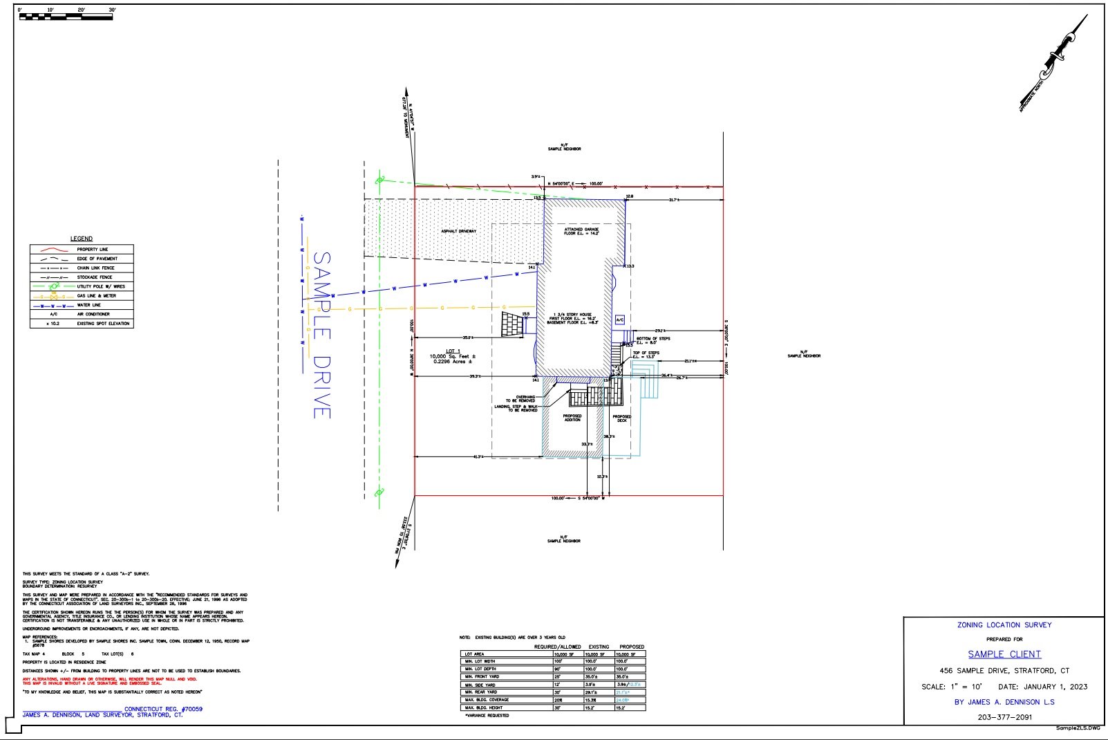
Zoning Location Survey
ZONING LOCATION SURVEY is a survey that depicts the location of existing conditions or existing conditions with proposed improvements to the property, for the purpose of obtaining building permits.
Boundary Stake Out Survey
BOUNDARY STAKE OUT SURVEY is a survey that depicts on the ground where your property lines are.
Property Survey
Property Survey For property transactions
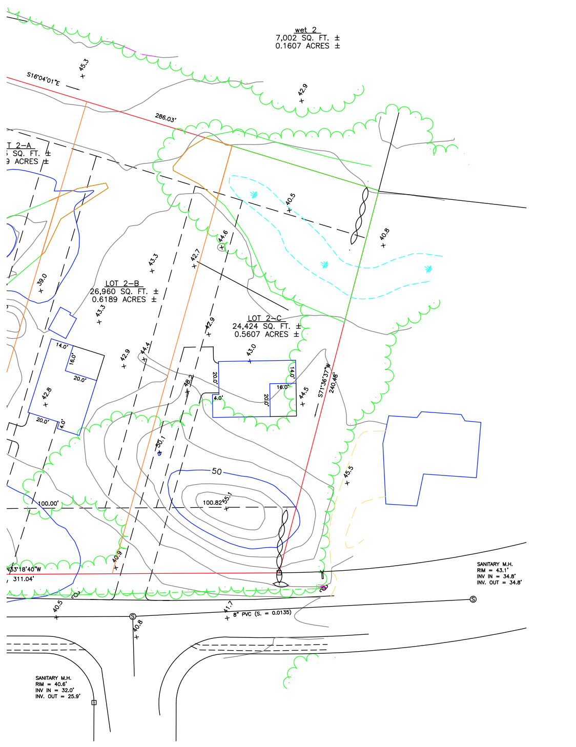
Topographical Survey
Topographical Survey For sight plan development associated with regrading, storm and sewer drainage.
Iron Pin and Cap
Iron Pin measures about 24 inches long and 5/8 inches in diameter. The iron pin will be placed vertically level to the ground on property lines and property corners. Then, orange cap will be placed on top of iron pin for clearer visibility. An orange flag will also help with visibility. (View next photo)
"Stake It"
Flag and Iron Pin clearly defines where the property line and/or property corner lay